Announcement: New Community Health Mapping Blog

Community Health Maps - Information on Low Cost Mapping Tools for Community-based Organizations

Kurt Menke, of Bird's Eye View, is contributing to a new FOSS4G related National Library of Medicine blog: Community Health Maps. The goal of the blog is to provide information about low cost mapping tools that can be used by community based public health organizations.  Perhaps you’ve seen the potential uses of mapping in public health, but are overwhelmed by the technology and/or simply too busy to pursue it.  I hope this blog will facilitate the use of GIS mapping for those that fall into this category.  I also hope to support those already engaged in mapping and enhance their community mapping initiatives, even if they may be using other tools.  The blog will be a mixture of mapping apps/software reviews, best practices, and the experiences of those who have successfully implemented a mapping workflow as part of their work. Training materials developed in 2013 are also available.

TrekWest Corridor Meeting

The Wildlands Network and friends met this last week in Salt Lake City to discuss TrekWest year 2. We were graciously hosted by Black Diamond Equipment. There were about 30 of us from 19 different organizations along the Western Wildway, aka the Spine of the Continent. John Davis was there to share his thoughts on his 10 month human powered journey to promote wildlife corridors. The focus was on protecting wildlife corridors. Stay tuned! 

TrekWest Meeting at Black Diamond Headquarters

The TrekWest crew meeting at Black Diamond Headquarters

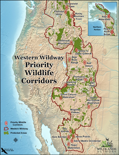
TrekWest Priority Corridors

2013 Year End Recap

The summer and fall went by so quickly! Unfortunately this blog necessarily took a backseat to the actual work. Thankfully the holidays have given me time to reflect on 2013. Professionally it was a fantastic year filled with great projects. Below are some of the highlights, in no particular order.  

  •  ~400 maps produced
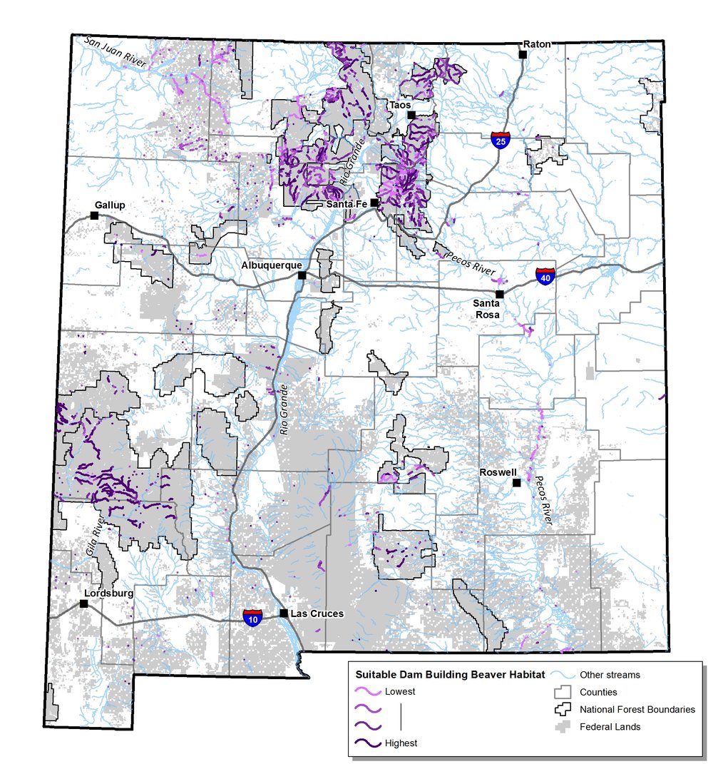
  • Modeled potential and suitable beaver habitat in New Mexico
  • Traveled to Seattle, WA and Honolulu, HI to train people in an open source data collection workflow
  • Taught the 5th installment of the Introduction to Open Source Software and Web Mapping at CNM...the best one yet!
  • Attending FOSS4G NA in Minneapolis, MN
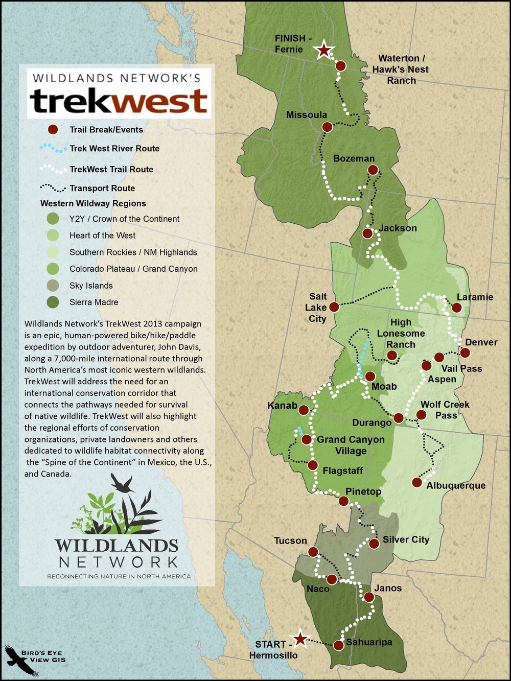
  • Supporting the Wildlands Networks TrekWest with route maps
  • Applied GIS to a wide variety of topics: wildfire, wildlife habitat protection, public health, wilderness proposals, travel management analysis, water rights, industrial noise, and parcel mapping.

Suitable Beaver Habitat

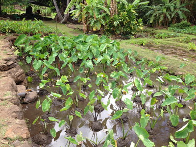
A tour of the Moana Lo'i (tarot field) and native Hawaiian permaculture

TrekWest Route map

FOSS4G-NA 2013

I just returned from my favorite conference, The North American conference on Free and Open Source Software for Geospatial (FOSS4G-NA). I know it's a mouthful. But it's a gathering of the brightest FOSS4G developers (aka geeks), and has a friendly atmosphere of collaboration and openness.  It covered two and a half days and included: pre-conference workshops, multiple plenary sessions, five concurrent paper sessions, lightning talks, code sprints, a Gala Event, panel sessions, and birds of a feather sessions. It was my first time in Minneapolis since the inaugural 2003 Mapserver Users Meeting and it was nice being back. 

One day standing in line for lunch I met two guys who were also in attendance 10 years ago, but we'd never met before. It was the guy in front of me and the guy directly behind me. We ended up eating together. What are the odds of that? It's those little moments of connection that make these events so much fun.

This year I noticed an even more distinct focus on web mapping technologies, and web development, than usual. With QGIS 2.0 just about to release it would have been great to hear a state of QGIS talk. I'd also really appreciate more sessions on spatial analysis. Maybe I'll need to sign up for one next time. After all there is more to geospatial than web development.

The opening plenary was one of the highlights. Erek Dyskant covered use of FOSS4G technologies behind the Democratic National Committee's recent presidential campaign. A stack of FOSS4G software was developed including PostGIS, QGIS and web services. This stack allowed access to current campaign related data in near real time to all nationwide staff. Field offices were then in a great position to prioritize door knocking and calling campaign, and maximize resources.

Another session of note had an educational focus with papers titled: The New Users, Adapting Web Mapping Curriculum to Open Source Technologies, and Building a Geospatially Competent Workforce with FOSS4G. This was especially interesting for me as I strive to keep my Introduction to Open Source GIS and Web Mapping course current in a rapidly changing field. I also heard valuable updates on MapServer, GeoServer, MapBox, OpenGeo, GDAL/OGR, Leaflet and OpenLayers 3.

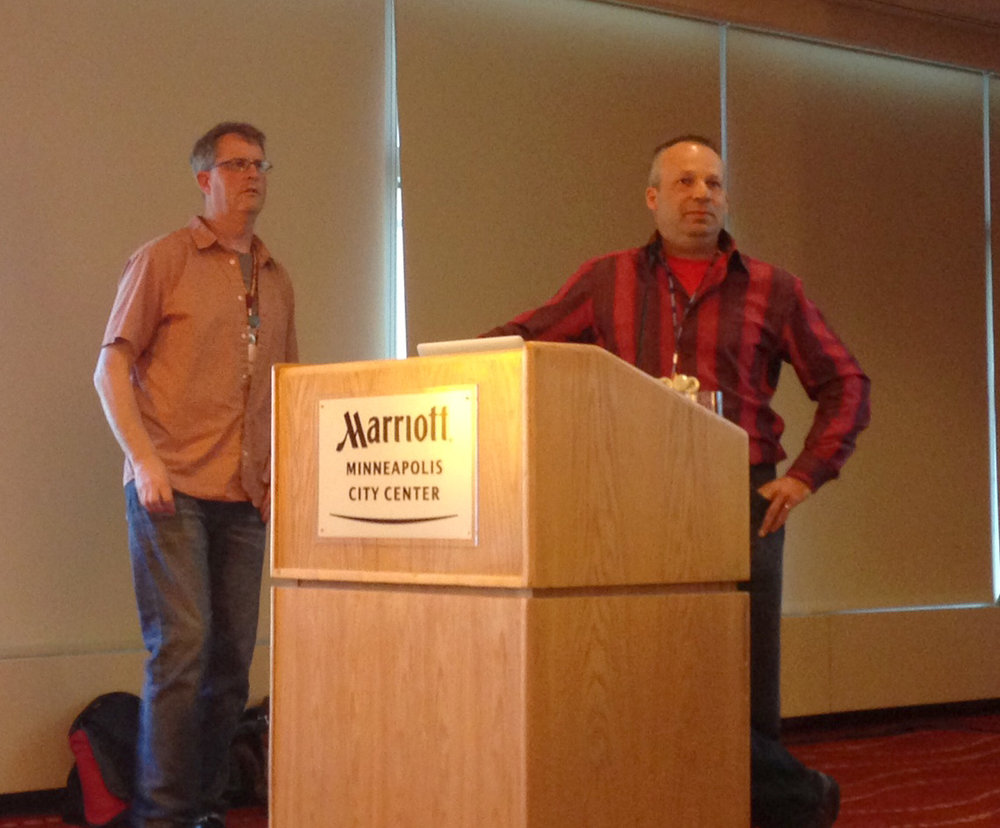
Steve Lime and Daniel Morissette answering questions about MapServer

The final session was a panel discussion on the use of FOSS4G in state and local governments. It was an interesting frank discussion. On one side it was about the political and bureaucratic hurdles in the way of organizations adopting FOSS4G. On the other were success stories of FOSS4G being utilized in state governments.

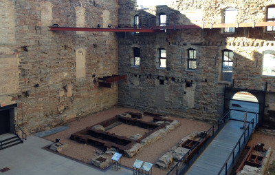
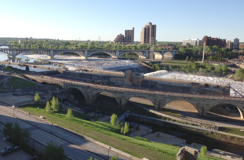
The Gala was held at the Mill City Museum in the ruins of the Gold Medal Flour mill on the Mississippi River. A gorgeous site. Seeing voluminous water is a treat coming from drought stricken New Mexico.

The ruins of the old Gold Medal Flour Mill

The view of the Mississippi River from the 8th floor of the old mill.

Plus I met a bunch of new folks! Kudos to the organizers for putting on another great show. It was a great conference!

************************************************************

END NOTE: If you're a geo-geek and into exercise you've got to get a Suunto Ambit. Here is the data from my walk back to the conference hotel from the Gala Event. I wasn't wearing my heart rate monitor, but it still collects elevation, barometric pressure, GPS, elevation, speed, temperature etc., and allows export to KML. Oh and you can navigate with it and it has a compass. 

My walk back to the hotel from the Gala event recorded with my Suunto Ambit GPS watch

Low Cost Tools for Mapping Community Public Health

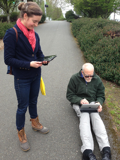
The past week was spent conducting training sessions on how to use a low cost workflow for public health mapping in minority communities. Trainings were conducted at two sites. The first site was the Urban Indian Health Institute in Seattle, Washington. They are monitoring noise pollution in urban indian populations. The other Papa Ola Lokahi in Honolulu, Hawai'i. They are working on a community public health assessment. The workflow starts with data collection using iPhones/iPads, moves into working with the the data in QGIS and finally data presentation via GIS Cloud.

Taking GPS and decibel readings in Seattle.There is an ever expanding ecosystem of geospatial apps for iOS. For this project we are evaluating EPICollect and GIS Pro. EPICollect is a free app designed to collect point data with a custom form. GIS Pro is a very expesive app. However, with the price comes a very intuitive and robust data collection system. 

An assortment of mapping apps for iPad

Once data is collected QGIS is used to combine the data with other organizational datasets, conduct spatial analyses and prepare maps. GIS Cloud is being used for final online presentation.

2013 Brings An Adjustable Height Desk to the Office

One of the best parts of my job is working at home. This allows me to cook and eat whatever I need to, anytime I need to, take breaks etc... For this I am eternally grateful. However, like most GIS folks, I also work at a computer 40-50 hours a week. I've been doing this type of work for 15 years now and it has taken a toll on me physically. In fact the side effects of working at a computer all these years is a big part of why I made the change and adopted the Paleo lifestyle two years ago. I experienced a very gradual physical decline, with a suite of evolving and nagging aches and pains. Tennis elbow, stiff neck, sore wrists, numb fingers, tight shoulders became my everyday reality. I feel significantly better these days as a result of eliminating grains, legumes, dairy, sugar and industrial seed oils from my diet, and following Mark Sisson's Primal Blueprint workout plan. The diet has reduced inflammation and the workouts have me moving again and getting stronger.

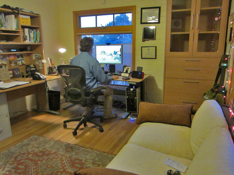
GeekDesk Max in sitting position

I'm still always looking for ways to improve my work space. I've used an ergonomic keyboard/ mouse tray for the last 4 years. I try and get up and walk around frequently too. Two years ago, I read this article in the New York Times. I've wanted an adjustable height desk ever since. I then started hearing all the news reports about how unhealthy it is to sit all day. For example, this piece aired on NPR and this blog post came up on Mark's Daily Apple. It's certainly not shocking news. However, it got me thinking about how much sitting I do between work all day, and lounging in the living room at night. I started realizing I not only want, but need, a desk that would allow me to stand at least part of the day.

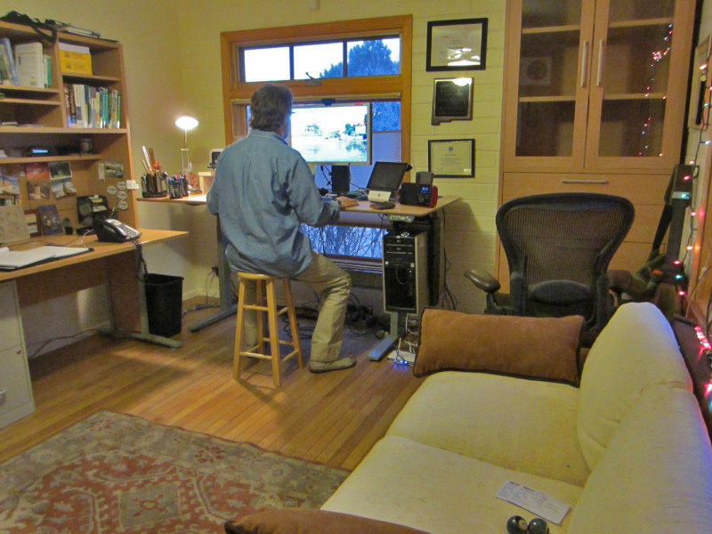
GeekDesk in an intermediate position

I felt almost immediately that the GeekDesk would be the perfect fit. It was at the right price and it matches my existing office furniture. Just before the holidays I ordered my GeekDesk figuring I could use the break to get it set up, and tear the old one down. Originally, I ordered the GeekDesk v3 in the 47" width. I then realized the GeekDesk Max had a nice feature, it comes with a control pad that allows you to preset four desk heights. That same afternoon I changed my order to the GeekDesk Max in the same size. Once it arrived I realized that the wider one would work better taking into account my CPU hangar and my space. The folks at GeekDesk were very accommodating with all these changes to my order. In fact they have some of the best customer service I've ever encountered.  In the end, they let me exchange just the parts that differed between the small and large desks - the table top and some braces.

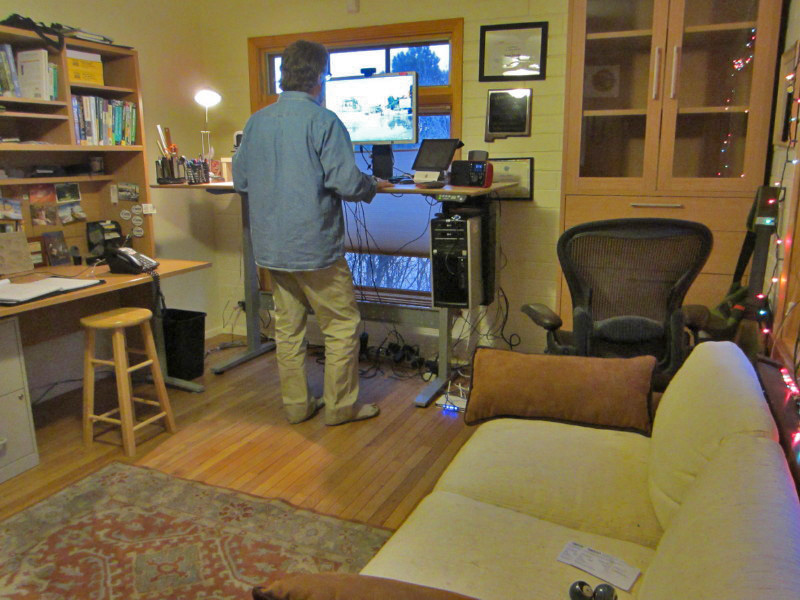
GeekDesk in standing position

I also purchased a CPU hangar to hold my computer underneath the desk. This keeps the computer with the desk as it raises and lowers. It was easy to install and works great with my HP workstation. I still need to either buy a new human scale keyboard tray or cut my existing keyboard track because it is too long to fit under the desk. Aside from that, my GeekDesk is now completely set up and works great. It will adjust from 23" to 48". I absolutely love it! It's been a seamless transition and it feels very natural to stand. I haven't gotten into any routine yet. I noticed though, that I seem to prefer standing in the morning while I'm reading and returning emails and surfing the web. Then while I'm working on more challenging tasks I tend to sit or use a stool. I now change the height of my desk half a dozen times a day!

GeeKDesk Control Pad with 4 presets and a height display

Sights from the 2012 AAG Conference in New York City

Last week I headed to New York City to attend the American Association of Geographers conference. I conducted a workshop for educators on teaching free and open source GIS (FOSS4G) and sat in on a panel discussion on teaching introductory GIS courses. I also had an opportunity to do a lot of urban hiking and exploring, some of which was lead by Kevin Patrick, an urban geographer from the Indian University of Pennsylvania. The weather was fabulous and the big apple was spectacular. Selected highlights are below.

 The Queensboro Bridge and sight of the famous scene in Woody Allen's 'Manhattan'.

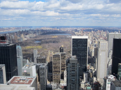
The view north from the Top of the Rock looking at Central Park.

The Dakota on Central Park West.

The old American Radiator Building, built in 1924, with the Empire State Building in the background. This is one of the most magnificent gothic art deco buildings in the city. It's now called the Bryant Park Hotel and is just south of Bryant Park and west of the New York City Public Library.

Grand Central Station buzzing with activity on an early weekday morning.

The Seagram Building at Park and 52nd. A classic modern skyscraper built in 1957 and site of a famous scene from 'Breakfast at Tiffany's'.

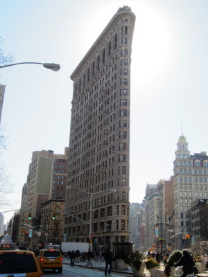
The famous Flatiron Building at Madison Square Park.

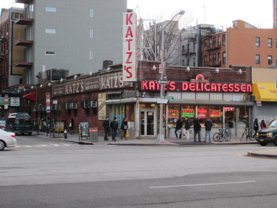
Katz's Delicatessen near 1st Ave and 1st Street in the Lower East side.

The lunch crowd at Katz's Deli.  Site of a famous scene from "When Harry Met Sally'.

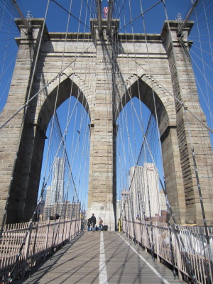
The Brooklyn Bridge.

The route of one days walk from the Lower East Side across the Manhattan Bridge into Redhook in Brooklyn.

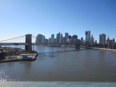
The view of the Brooklyn Bridge from the Manhattan Bridge.

Fear, Uncertainty and Doubt

There are two factors that stop people from exploring or adopting free and open source (FOSS) GIS software. The first is fear, uncertainty and doubt (FUD). While it's true that corporations, such as Microsoft, have used FUD as a marketing strategy (purposely spreading FUD about OS software), FUD regarding FOSS GIS software is now commonly spread by GIS users themselves. I don't think this is intentional. Rather, it can be counterintuitive for people who have grown up in a competitive capitalist society to understand why anyone would create and use free software.

Initially people often wonder:

  • How can I make money using FOSS software?
  • Why would anyone create FOSS software, what's in it for them? 

The other main factor is unfamiliarity. Over the last two summers I've taught a semester long course called, Introduction to Open Source GIS at the local community college. The GIS program at my school, like most, is ESRI-centric. A majority of the students are very surprised to learn about the broad array of FOSS GIS software. Once exposed to FOSS software, such as QGIS, they ask, "Why doesn't everyone use it?" It comes down to a combination of these two factors.

In full disclosure, I also use ArcGIS almost every day. However, I also utilize all the leading FOSS GIS software. I consider them all valuable tools in my toolkit. One of the nice features of FOSS GIS software is that it's free. So there is absolutely nothing preventing you from downloading a FOSS GIS package and trying it out. If it doesn't meet your needs just uninstall it. My hope is to inspire people to do exactly this.

This year the FOSS4G Conference is in Denver, CO and very accessible to those of us in the USA. The timing couldn't be better to learn more about FOSS4G. While FOSS GIS software has been around since the 1980's, recent years have seen the software becoming much more mature and user friendly. There are great FOSS GIS products for the desktop, web server, web client, spatial database and mobile GIS. There are now intuitive Windows installers for all the leading packages.

So, if you have questions like:

  • What is free and open source software?
  • What FOSS GIS software is out there?
  • Is it really free?
  • Does it work?

you should sign up for the Introduction to Geospatial Open Source at this year's FOSS4G conference

Hope to see you there!

HR 1581: The Great Outdoors Giveaway Act

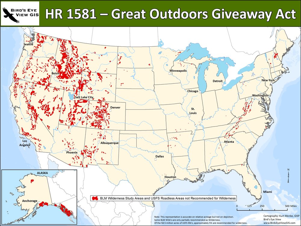
Officially called the “Wilderness and Roadless Area Release Act," HR 1581, recently introduced by Rep. McCarthy (R-CA) and co-sponsored by Rep. Pearce (R-NM), would roll back protections from 58.5 million acres of Forest Service roadless areas and another 6.7 million acres of BLM Wilderness Study Areas. The bill would nullify the Roadless Rule and eliminate all Wilderness Study Areas. Bird's Eye View created the map below for the PEW Environmental Group to highlight the issue.  Protections would be removed from all the red areas in this map. This has caused a broad coalition of conservation organizations to call it the Great Outdoors Giveaway.

All of these areas represent potential wilderness, and they would all be opened to road-building and off-road vehicle use–impacts. Not only would existing protections for these areas be reversed, but future administrations would be prevented from ever protecting Wilderness Study Areas or unroaded Forest

Service Lands.

For more information go to: PEW Environmental Group

FOSS4G Workshop for Educators at FOSS4G

This fall Bird's Eye View (with the support of the GeoTech Center) will be holding the FOSS4G Workshop for Educatorsat the Free and Open Source Software for Geospatial Conference (FOSS4G) in Denver, Colorado. This is exciting for at least two reasons. Having the FOSS4G Conference in North America, let alone the United States, is fairly uncommon. In recent years it has been held in Australia, South Africa and Spain. Secondly, the workshop will premier one of the only FOSS GIS curricula in the United States. Entitled Introduction to Open Source GIS and Web Mapping, it is currently being taught at Central New Mexico Community College.

Free and  open source software comprises one of the fastest evolving sectors of GIS. While FOSS GIS software has been around since the 1980's, recent years have seen the software becoming much more mature and user friendly. There are great FOSS GIS products for the desktop, web server, web client, spatial database and mobile GIS. Historically, ease of access and installation has been a major hurdle for those wanting to transition to FOSS GIS software. Now there are intuitive Windows installers for all the leading packages.

The course is expected to become increasingly important to the CNM program. In New Mexico, employers are starting to favor applicants with knowledge of both ESRI and FOSS applications. This is in part due to the economic times. Students at CNM and elsewhere learn GIS in pure ESRI environments. Most are shocked to discover how many capable FOSS GIS software packages exist.

The course sticks to a pure FOSS paradigm. For example, assignments and lectures are provided in Open Office versus Microsoft Office. The students are not introduced to much new GIS material in the course, save web mapping. Rather they are shown how to do things they have learned in other foundational courses using FOSS GIS software. The packages used include: Quantum GIS, GRASS GIS, GDAL/OGR, SpatiaLite, PostgreSQL/PostGIS, and MapServer. They are also introduced to open standards and open data. Midway through the semester they are given a final project assignment. For this they research a FOSS GIS package not being covered in the course lab, and during  the last week of class they present their findings to the class. This exposes the students to a large number of new tools.

The web mapping portion is an introduction to web mapping and the web in general. Part of the overall goal for the course is to make it accessible to students who have completed the Introduction to GIS course. So, this course has no programming requirement. Google maps (although no open source) is used as a gentle introduction to web mapping. Then students move on to labs where they use MapServer to create basic web mapping applications.

The workshop this fall will target educators wanting to incorporate FOSS GIS into their curricula, or those who are just curious about what FOSS GIS is and what it can do. The course goals, readings, labs and exam structures will be shared. Attendees will also get to try their hand at a lab or two. For more information visit the conference workshop page.

Some maps of the Wallow fire in Arizona

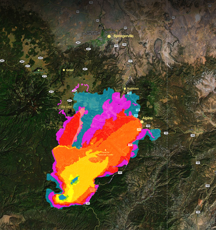
The Wallow Fire in Arizona has now burned more than 300,000 acres and is 0% contained. This makes it the third largest wildfire in Arizona history so far. The smoke plume is spreading past the Rio Grande Valley in New Mexico.  Visibility in Albuquerque has been reduced to 1 mile or less several times during the last week. Here are some of the more interesting maps I've seen recently.

From AZ Central.com here's a fire progression up to June 6th.  You can click on the link go directly to the site.

From NASA here is a MODIS satellite image from June 4th showing the smoke plume spreading far into New Mexico.  Click on the image to go directly to this NASA site. 

From Wildfire Today here is a map of fire danger across the lower 48.

Society for Conservation GIS Agenda Posted!

The agenda for the SCGIS 2011 Annual Conference is online.  This years conference will be held at Northwoods Resort in Big Bear Lake, California (July 16 -19).

Highlights include a keynote address by ecological niche modeling expert Dr. Richard Pearson (AMNH), and a special symposium on Wildlife Habitat Connectivity.  

The symposium includes talks and technical presentations by Dr. Paul Beier (NAU), Dr. Dave Theobald (CSU) and Dr. Carlos Carroll (Klamath Center for Conservation Research ).  Each of these researchers is on the leading edge of connectivity research for wildlife. If you're interested in this topic this symposium is not to be missed!

The remainder of the agenda is full of great talks and workshops including topics like, climate change, aquatic and marine GIS, technology tips and tricks, collaboration, habitat modeling, and sustainable development. 

I hope to see you there!

A day of hiking and birding after a long week of GIS

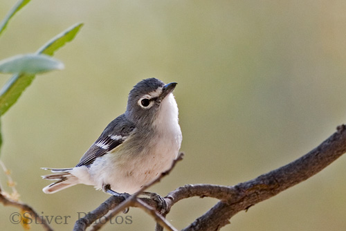
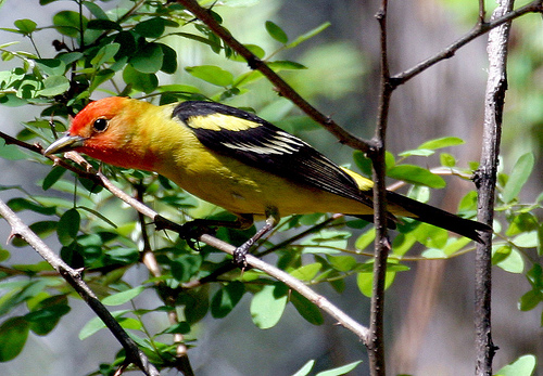
Embudo Canyon HikeAfter a long week at the computer, today I was able to get out and do some hiking in the Sandias! I started out early and headed up the Embudo trail. The trail was quiet and when I reached the seeps from Embudo Spring there were birds everywhere. The assortment of birds included some of the most colorful the Sandias has to offer. The highlights included a both Black-chinned and Black-throated Sparrows, a flock of Western Tanagers, several Yellow-rumped Warblers, an American Redstart, a Plumbeous Vireo and the ubiquitous Spotted Towhees.  Also heard were lots of Canyon and Rock Wrens.  Photos below.  NOTE:  I can't take credit for the bird photos.  I found redistributable photos off of the internet just to pass on the beauty of today's birding trip. 

American RedstartPlumbeous Vireo

Western Tanager

Black-throated SparrowBlack-chinned Sparrow

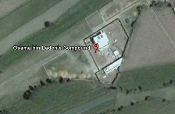
Will the real Osama Bin Laden compound please stand up.

In the hours after the announcement of Bin Laden's death people scrambled to Google Earth to find the location of Abbottabad, Pakistan and the compound. There were several incorrect guesses, like the example I found below, and posted Sunday night.

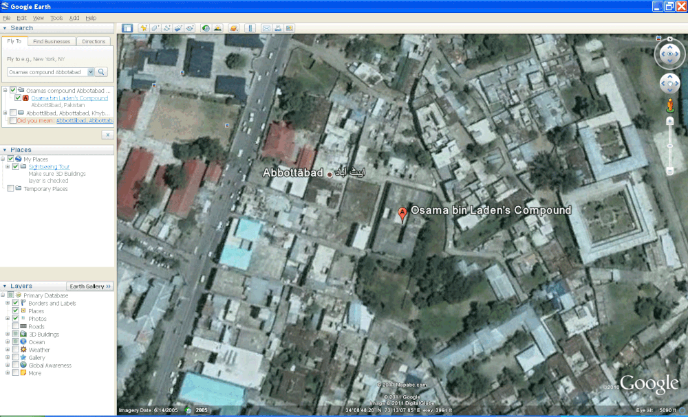
Part of the issue was that until yesterday the imagery Google had for the area was acquired in 2001, years before the compound had been built.  Yesterday Google updated their imagery to data acquired on June 14, 2005 (ZDNet).  In the 2005 data (below) the compound can be seen in an unfinished state.

Below is an image of the compound in it's current state from the CIA.

FOSS4G is in Denver this year!

Join us in Denver this fall for the FOSS4G Workshop for Educators.  FOSS4G hasn't been in the U.S. since it was called Open Source Geospatial and was held in St. Paul, Minnesota in 2005.  So it's a great opportunity to learn about the latest in free and open source for geospatial software.  Our workshop will cover the semester long Introduction to Open Source GIS course developed for Central New Mexico Community College (CNM).  That course will run this summer starting on May 24th.  Come learn about QGIS, GRASS, GDAL/OGR, Mapserver and PostGIS!